
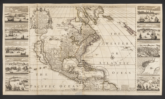
Map
Published by Henry Overton I (1676–1751)
London, England; 1741
Engraving, etching, and watercolor on laid paper
Museum purchase with funds drawn from the Centenary Fund 2019.0034
This geopolitical map shows settlements in territories under English, Spanish, Dutch, French, and Indigenous rule at the time it was published in 1741. The vignettes depict trading ports relevant to the sourcing of materials and the furniture in this exhibition.
A New & Correct Map of the Trading Part of the West Indies, including the Seat of War between Great Britain and Spain; Likewise the British Empire in America, with the French and Spanish Settlements adjacent thereto; Adorned with Prospects of the most considerable Towns, Ports, & Harbors &c therein contained from the latest & best observations.